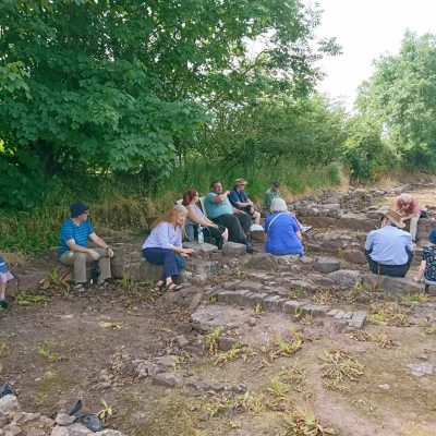
On a very hot Saturday afternoon an intrepid group of 12 BAAS members, led by Mike Gwyther, visited the ‘lost city’ of Trellech.
Now a small village lying halfway between Chepstow and Monmouth, in the late 13th and early 14th centuries Trellech was one of the largest towns in Wales; a total of 398 houses being recorded in 1288.
We began our tour with a walk through the village, which contains a number of attractive 18th and 19th century houses, to St Nicholas’ Church. The disparity between the size of the church and the modern village is striking and clearly suggests that there may be more to Trellech than immediately meets the eye.
St Nicholas’ is a handsome early 14th century structure in a simplified decorated style with a low chancel, a tall aisled nave and west tower with octagonal spire. There are slight indications that the tower is an addition but it appears to be close in date to the rest of the nave. Unfortunately, we were unable to visit the interior as a wedding was in progress; though a few determined members were not to be deterred and returned to the church post-wedding at the end of the day. The interior contains no fittings earlier than the 16th century (main door dated 1595). The church was restored in 1893 and again in 1903 when the chancel floor raised. In one or other of these works the form of the chancel arch was altered and it was heightened.
Immediately west of the church is a field with an intriguingly bumpy surface while between the field and the church is a green lane that reportedly once showed signs of paving. An area of the field was excavated in 2000 by Dr Ray Howell of the University of Wales, Newport, who revealed a large medieval building, interpreted as a possible hospice.
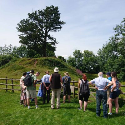
From the church we walked south a short distance to Court Farm (a possibly significant name). In a field between the farm and the church lies a motte, known as Twmp Terret. The motte is a ditched mound c. 36m in diameter and 5.5m high with a counterscarp visible at the ditch edge to the south. No history is known. The area was occupied by the Normans at a very early date but the castle is first mentioned in 1231 and referred to as the ‘site of an old castle’ in 1306. Features on the motte top are thought to relate to a 19th century summer house. The location of the bailey has been a subject of speculation but in the early 21st century geophysical survey indicated structural remains to the north and north east and this was confirmed in 2002-03 when excavations by Neill Phillips revealed traces of a trestle bridge across the ditch on the north side.
Immediately south of Court Farm is a marshy hollow, marked as fish ponds on early OS maps but which at its western end clearly turns north as if to enclose the village. The feature has previously been identified as the remains of a defensive ditch, perhaps further research will provide some clarity.
From Court Farm we proceeded south along Catbrook Road to the highlight of our tour, a visit to the ‘Lost City of Trellech’ excavations.
The location of the 398 burgages recorded in 1288 had long been a mystery. The present layout of the village is clearly far too small to accommodate this number of plots even allowing for the loss of at least two former roads in the village. In 1998, Julia Wilson proposed that the bulk of the burgages lay south of the modern village, along Catbrook Road. She pointed out that not only is this road lined with unusual narrow fields for over half a mile south of the village but many of these fields appeared to show evidence of house platforms. Subsequent small-scale excavations proved her hypothesis is correct and in 2002 Stuart Wilson (no relation) began the ‘Lost City’ excavations in a field alongside Catbrook Road.
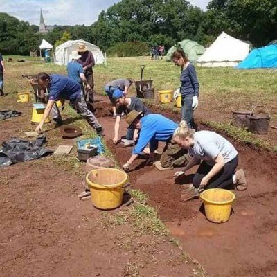
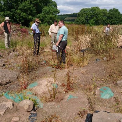
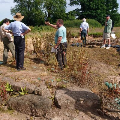
Stuart, and a dedicated band of volunteers, have continued excavating every year since 2002 and a large area has now been opened-up. Stuart welcomed us to the excavations and showed us what has been discovered so far.
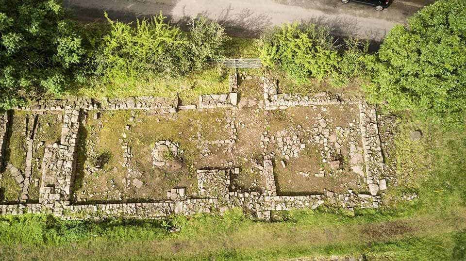
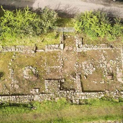
Alongside the modern road, which has been shown to overlie a medieval road surface, is a range of stone buildings interpreted as workshops, possibly for iron processing. To the north of this range and joined to it, are the remains of a high-status house comprising a hall parallel to the road, with remains of the dais and a central hearth. To the south of the hall are features interpreted as the access stair to an upper chamber, also parallel to the road. To the rear of the hall/chamber block is a paved courtyard approximately 8m. square with a detached kitchen to the north, further ranges of small buildings to the south and an enigmatic circular feature, 6m. in diameter, to the east.
The courtyard and kitchen both contain a well-preserved series of stone built drains, some of which appear to run under the adjacent buildings and several of which terminate at a large stone block in the centre of the kitchen. What lies under this block is unknown as heavy lifting equipment will be necessary to move it. However, there is a very well preserved, and still water-filled, well in the courtyard.
Excavations in 2017 on the well-marked house platforms further south in the field failed to locate any structural remains though a very large number of small finds were recovered. Interestingly, this is similar to excavation results in the modern village where it has proved difficult to identify structural remains even when geophysical surveys have clearly suggested the outlines of burgage plots.
Stuart outlined his theory that medieval Trellech essentially only consisted of the buildings along Catbrook Road and that the site of the modern village was a non-residential administrative area. Other interpretations are possible and it is clear that much wider excavations in and around the village are necessary before a clear picture of medieval Trellech can emerge. The possibilities have been recently demonstrated by the Chepstow Archaeological Society, who uncovered a large medieval building at the extreme north-east corner of the village.
Mike would like to offer his thanks to Stuart for permission to visit his excavations and for the time he very generously gave to the group during our visit.
(Images copyright www.lostcityoftrellech.org)
(Images Katie Churchill)